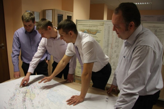
Geological studies
Prospecting and exploration of hydrocarbon deposits
Main activities and services provided:
- prospecting and preparation of potentially productive structures to deep drilling by seismic prospecting and/or geological methods;
- designing of projects on exploration and development drilling, designing of seismic works 2D/3D, designer supervision;
- construction design of exploration and production wells with depth more than 6000 meters;
- development of geological exploration programs;
- real-time analysis and integration of drilling and seismic survey data in order to specify directions of further activities;
- specification of geological structure of oil and gas fields in order to additionally explore them;
- quantitative estimation of resources of a hydrocarbon region.
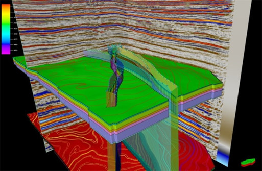
Processing and interpretation of seismic data
Specialists of the departments perform a range of procedures in the course of carrying out processing and interpretation of 2D and 3D seismic surveys and vertical seismic profiling using the latest software packages:
- processing of seismic data 2D and 3D (Echos_Epos/Echos_CT 2011.3, Power2D3D, GeoDepth);
- calculation of static corrections from the model of refractors (Seismic Studio);
- work with the archive of seismic data (ProSouce SEISMIC);
- structural and dynamic interpretation (Petrel Schlumberger, Probe2D3D Paradigm, Vanguard_RC Paradigm, SeisEarth_XV Paradigm, GeoStatistics Paradigm, VoxelGeo Paradigm, SeisFacies Paradigm);
- processing and interpretation of VSP data (Univers);
- geoseismic modeling (Tesseral).
Usage of the modules mentioned above allows for implementation of the following stages in processing and interpretation of seismic data:
- processing of 2D and 3D seismic data by standard and special graphs;
- generation of depth-velocity models;
- migration mapping of seismic data;
- studies of near-well space and prediction of section below the bottom hole;
- seismostratigraphic referencing;
- correlation of seismic horizons and faults in time and depth domains;
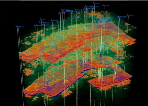
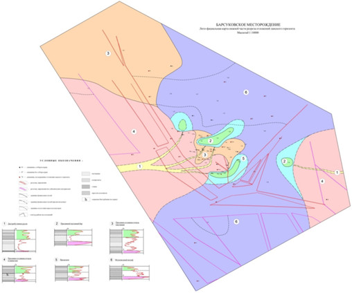
- generation of structural maps on target horizons;
- the full cycle of dynamic analysis (seismic facies analysis, spectral decomposition, seismic inversion, geoseimic modeling);
- obtaining of petrophysical parameters and prediction of porosity and permeability properties in the interwell space.

Processing of geological well data
Twenty-four-hour geological-geochemical monitoring of drilled wells and lateral holes, including:
- real-time delineation of oil and gas saturated objects;
- integrated interpretation of the results of continuous geological studies with production logging and formation testing data;
- real-time decision-making regarding geological and geophysical operations in a well, based on the information obtained by direct methods;
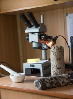
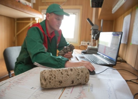
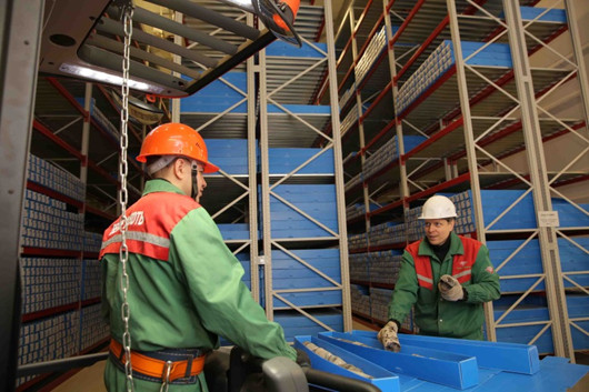
- supervising of core sampling, real-time processing of rock material, photo documentation, conservation of core material and timely delivery of rock samples for different types of studies;
- analysis of flow tests performance in order to evaluate the quality of the obtained parameters and analyze hydrogeological conditions of a drilling region.
Lithology and stratigraphy
Lithology and stratigraphy department performs the following types of work:
- receiving core from drilling sites of the company and other enterprises, its registration, marking and documenting;
- referencing core sample intervals to well logging data;
- color core photography in white and UV light;
- core sample splitting;
- core sample preparation for laboratory research;
- control of procedure of storing, transporting, referencing and sampling of cores and cuttings for integrated laboratory studies, maintenance of a computer database;
- laboratory research using core material of terrigenous and carbonate deposits;
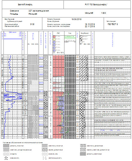
- lithological and stratigraphic layering and correlation of sedimentary deposits of the drilled out regions by production logging data and results of core studies;
- creation of reservoir correlation schemes with further delineation of reservoir components and its codification;
- macroscopic description of full size cores with litho-sedimentological column creation and lithotype determination;
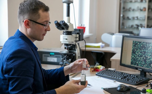
- microscopic description of petrographic thin sections;
- creation of lithofacies and seismic facies maps in order to determine the features of sedimentation environments;
- estimation of hydrocarbon potential, determination of forecast areal extent of reservoirs.
Petroleum geophysics and estimation of oil and gas reserves
Geophysicists of Belnipineft R&D Institute carry out activities and provide services, associated with:
- processing and analysis of core-based laboratory studies with creation of a petrophysical model;
- processing and interpretation of geophysical data (production logging data) in an open hole interval of drilled exploration and development wells;
- processing and interpretation of geophysical data (production logging data) in an open hole interval, using self-contained complex of equipment on drill pipes in subhorizontal and horizontal wells;
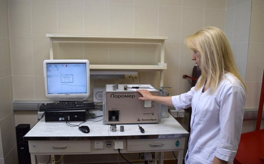
- determination of porosity & permeability properties of reservoirs;
- determination of clay content and its mineral composition by a standard set of production logging and gamma-ray spectrometry data;
- prediction and substantiation of water-oil contact (WOC);
- determination of water saturation factor in an open hole by the methods of lateral logging, inductive electro-magnetic logging, side-wall resistivity logging and also in the string by the methods of impulse neutron-neutron logging and C/O logging;
- detailed lithological sectional layering and creation of volumetric mineralogical model of reservoirs and matrix rocks;
- evaluation of anisotropy of void space structure and prediction of reservoir inflow by full-wave acoustic logging data;
- determination of stress-related properties of reservoirs and matrix rocks;
- well-seismic tie;
- creation of synthetic density curves and acoustics based on a rock model and theoretical or empirical equations for dynamic interpretation of seismic data.
Our partners and customers in the Russian Federation:
- LLC «Neftegazgeofizica»;
- JSC R&P company «VNIIGIS»;
- JSC R&P company «Geofizica»;
- LLC «GeoTEK»;
- LLC «KogalymNIPIneft»;
- LLC «Lukoil-Perm»;
- LLC «Ritek»;
- PetroTraceGlobal;
- Schlumberger;
- Paradigm;
- CGG.

In the field of reserve estimation we provide the following services:
- estimation and audit of oil and gas reserves on the fields of any extension and category of difficulty, represented by carbonate and terrigenous reservoirs with different structure of storage volume;
- technical and economic feasibility of oil recovery factor;
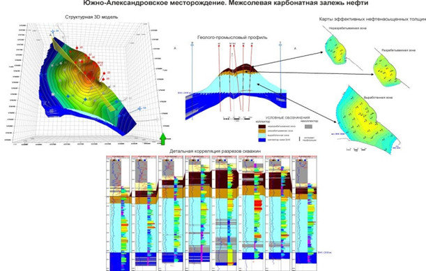
- construction of 3D geological models.
In order to solve the set targets, the following activities are performed:
- validation of an oil field geological model, based on the analysis and generalization of geological, geophysical and field data, field development data, the results of 2D and 3D seismic survey interpretation;
- detailed study of geological structure and oil and gas bearing capacity, delineation of estimation objects and geometrization of deposits, based on correlation of reservoir intervals;
- integrated interpretation of production logging data, results of laboratory studies of cores and fluids, well testing data;
- determination of reservoir properties;
- substantiation of petrophysical dependences and estimated parameters;
- differentiated estimation of oil and gas reserves;
- real time estimation of reserves by the results of exploration and development drilling;
- estimation of reserve recovery and localization of remaining oil reserves field-wide;
- monitoring of exploration and development well drilling and control of planned geological activities;
- reporting on reserve estimation in compliance with the acting guidelines of the Republican Reserve Committee (Belarus) and State Reserve Committee (the Russian Federation), recommended practices and regulations;
- reserve estimation over the structures, prepared within a year;
- preparation of an annual balance of oil and gas reserves and resources (form 6GR);
- monitoring of raw material base.
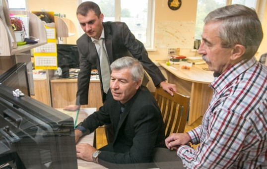
Information and technical support for geological exploration activities
Specialists of the Institute at a high professional level provide services, associated with:
- creation of geological-geophysical and field databases (ORACLE), pipeline databases;
- development of software for maintenance and monitoring of geological-geophysical, field and pipeline databases;
- digitization of logging materials;
- scanning of well files and reports;
- digitization and filing of cartographic information (Mapinfo).
We have had experience of creation and maintenance of data banks on the fields of Russia, Ukraine, Iran, Venezuela, Nigeria, Ecuador.
BelNIPIneft has a powerful computing system of integrated processing of geological and geophysical information for efficient combination of conventional methods and approaches in prospecting, exploration and development of oil fields, using up-to-date computer technologies.
Computing system of the Institute includes numerous servers and graphics stations. The computing system contains high performance computing cluster with 1024 hardware cores, 8 TByte of operation memory, 330 TByte of storing system for seismic data processing.
We use special licensed software for oil and gas industry by the world's leading companies-software developers: Shlumberger, Paradigm Geophysical, Autodesk, Bentley, Roxar, Kappa, CSoft, Askon, Carbo, Credo-Dialogue and many others.
The Institute has created an integrated information data base. All the information within the database is organized by the following groups: geological data, well logging data, data on methods and technologies of drilling and production, development data.
Specialists of the Department for creation and maintenance of the database run and constantly enlarge the database, using database managers Oracle, PROSOURSE. We develop software for creation of cartographic and knowledge databases, based on Oracle.